 ">
">
CRS Conference 2026

The 2026 Conference will be held July 30-August 1 at Pensacola Christian College in Pensacola, Florida.
About The Conference
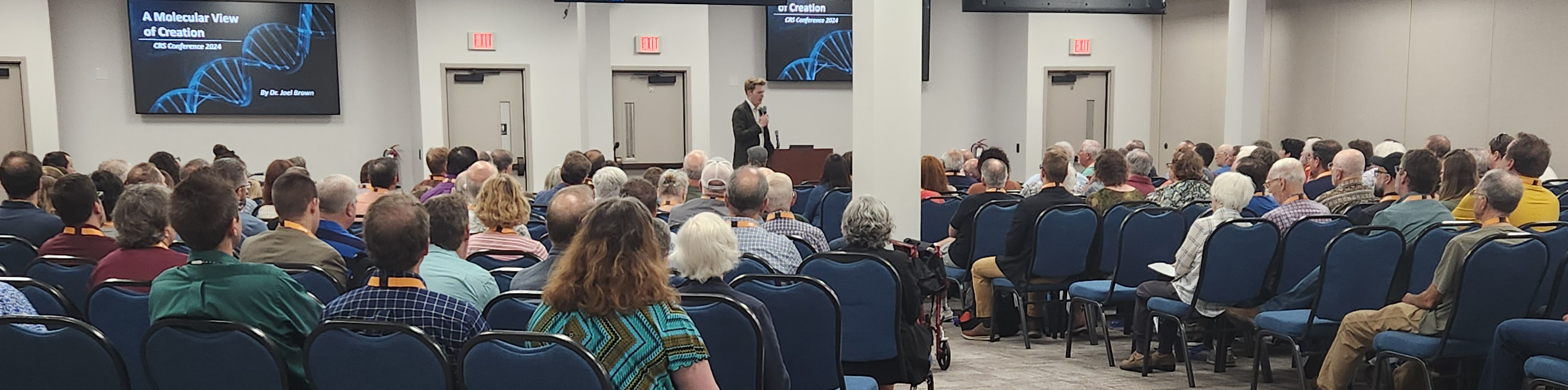
The purpose of the Creation Research Society’s Conference is to provide a forum for our members to present their latest research. We highly encourage members to present not only well-developed and tested ideas and results, but to also present new and tentative ideas and even speculations. Some of these ideas may eventually mature and develop into fully established research, while others may never fully sprout. Either way, this conference provides an excellent opportunity for a “test drive.” As such, there are no proceedings nor recordings of any of the concurrent sessions. The conference also provides a wonderful opportunity for interaction among members of the Society, helping to promote collaborations and exchanges of ideas.
It should be understood that the CRS Conference is not a family conference with activities and entertainment for all ages. This is a science conference and presentations will be scientific or theological in nature – many may be a little technical. However, even attendees that do not understand all that was discussed during a presentation still find they have learned some interesting facts and leave the conference with new ideas and understanding.
Presentations during the concurrent sessions will be selected from a pool of abstracts that are submitted by various researchers who are interested in presenting their work (see submission instructions below). These abstracts are selected based on originality, novelty, and general interest to the creation community. As such, these abstracts are not peer-reviewed and receive only limited editing. Attendees may find some of these presentations less tenable than others, but this is all in keeping with our goal of providing a forum for the free flow of ideas among fellow creationists.
The conference also holds the Henry Morris Memorial Lecture (HMML) which is free and open to the public. Each year the HMML has been presented by a creationist who worked with Henry Morris or who has made a significant impact in creation research.
Extra Events
Preconference "Reclaiming Science" Event (In partnership with Creation Today)

Workshops
CRS will host several pre-conference workshops. These workshops will serve as a discussion group for people with a basic knowledge of the respective topics. As such, the workshops are not intended as a seminar or teaching session. Rather, attendees of these workshops should come prepared to provide input and ideas that will help advance the creation model within the respective topics of each workshop. These workshops will be held from 9 am – 5 pm, Thursday, July 30. Participation in these workshops is free with a paid CRS Conference registration.
- Research + Engineering: Why and How? Led by John Swan and Fred Harmon, this workshop is about equipping researchers and techies to enhance collaboration and prediction development by looking into a design model used by system engineers. The secret to accomplishing that will be revealed in the workshop. It will also include examples of how to recognize design engineering revealed in nature, consider AI for creation research, and copious time for Q/A and discussion.
- Biology Workshop: In Pursuit of Dinosaur DNA (and more) Led by Joel Brown, this workshop will focus on recent advances towards extracting and sequencing dinosaur DNA. This will include an update from several researchers in the Society who will share about the current work being performed in their labs. We will also take some time to discuss important discoveries in the field of biology over the last year and how they relate to creation science in an engaging journal-club format.
- Geology Workshop - Led by Nathan Mogk and Nate Loper. The geological effects of the Flood justly receive a great deal of attention. Post-Flood geology is comparatively neglected. The creation model’s view of geologic change is fundamentally non-uniformitarian, and so necessitates a different perspective on recent and modern geological processes than the conventional synthesis. This workshop will be a forum to collaboratively develop a more holistic model of young-age geology. Participants are encouraged to bring contributions on topics including: methods of tracking time post-Flood, recovery and dispersal of life, post-Flood catastrophes, intersection of geology and archaeology, climate, rheology, modern geological hazards, etc. Though perspectives will be informed by one’s preferred Flood boundary view, this forum will not address Flood boundaries.
- Astronomy Workshop - Details to be announced.
Open Mic Session
Take off the gloves and join the fray in our first ever open-mic sessions. Conference attendees can claim one of six 10-minute speaking slots to share their ingenious (or crazy) creation-related ideas. These *uncensored presentations may include content that would not pass the peer-review process for a standard CRS conference presentation...you have been warned. At the conference, interested participants can submit 1 title slide + 5 content slides to the moderator in advance to have a chance at being included in the open mic session. If more than 6 individuals submit content, presenters will be chosen randomly to present. Prospective presenters may only submit one set of slides and must be current CRS members. Caution: Tomatoes will be thrown. *Content must be related to creation, evolution, science or the Bible. The moderator reserves the right to exclude content which is deemed inappropriate for the CRS conference (i.e. unbiblical, offensive, derogatory, inflammatory, etc.).
Send-off Picnic
On Saturday, August 1, 2026, there will be an End-of-the-Conference picnic. Picnic is free with a paid CRS Conference registration.
*Prices increase June 1, 2026
Register for the conference.